Biology Meets Technology
"The best" monitoring method does not exist! We know most of them and are happy to share our experience with you. Our open and interdisciplinary philosophy leads to progress. This might be the use of new technology or the development of new study designs.
Between "mouse" and "deer", there are a lot of possibilities. We are powered by the aim of finding your best solution… just give us a call.
News
October 2019
We start a new genotyping project for red deer in Vorarlberg, Austria
August 2019
We are testing new airborne and terrestrial study designs in the Alps
June 2019
Braving the heat: Chamois monitoring in Triglav National Park

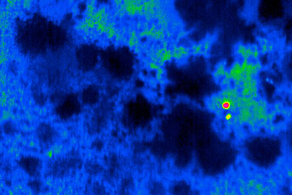


Standardized Aerial IR-VIS-Counts
While the thermal infrared data is used for the detection of the animals, the high resolution RGB Images are used for the species specific identification. For more reliable estimates habitat specific detection rates are used. If many detection events occur under dense vegetation, a low detection probability leads to a bigger correction, where as more open habitat results in actually higher counts. The scanned area can be derived out of the height over ground, the field of view of the camera and the length of the transect. Beside the estimate of the density, this method gives valuable information about the distribution and habitat use of the animals.
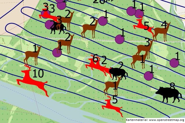


Active Search Flights
Searching and counting actively out of an airplane is especially suitable for open and semi open habitats and species who are living in groups. Furthermore, lakes (for avifauna) and shorelines are very suitable habitats for active flights. High resolution images are used to document and count the animals after the flight. Depending on the species, the data can also be used to obtain further information like the sex ratio. Depending on the study design it is possible to derive density estimates but very often the data is being used as an index for increasing or decreasing stocks for which reason a time series of data is important. Active search flights are nearly free from interference, quick and very cost effective.


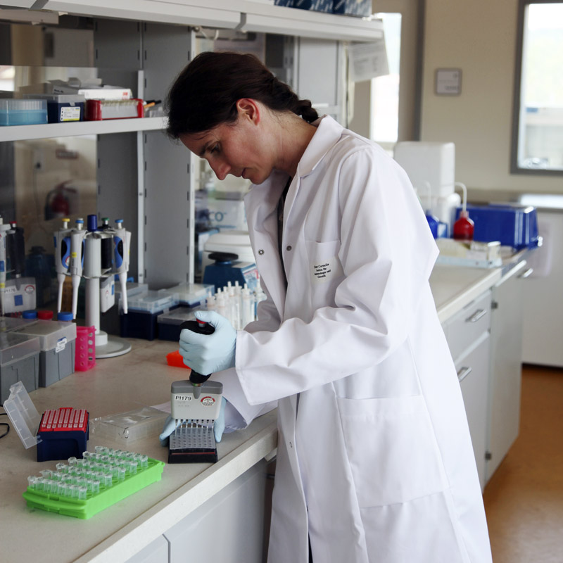
Wildlife Genetics
We advise you with the planning and preparation of genetic projects and issues. As we have also extensive experience in conducting field sampling and in the analysis of genetic data, we can accompany your projects from the planning to the population genetic analysis or to the population estimate.
We collaborate with a laboratory for molecular biology (Seq-IT; www.seqit.de) in Kaiserslautern, which is specialized in the analysis of small amounts of DNA from non-invasively collected samples such as faeces, hair or saliva.
Examples for genetic studies are:
- Population and density estimates
- Determination of the sex ratio
- Paternity testing
- Population genetics
- Use of space
- Species conservation genetics (eg. wild cat vs. domestic cat, bats, etc.)

Spotlight Counts
The study area is being sampled at night with two spotlights looking right and left out of the windows of an all-terrain vehicle. For larger areas usually several vehicles are being used at the same time. In the beginning of spring especially the attractive green pastures are monitored. This method is used in Europe mainly for deer and hare. As a simple method, it can be applied very well with the involvement of volunteers, for example, in a hunting community.


IR-Taxation/Distance Sampling
The study area is sampled at night with thermal imaging devices. Literally one ear sticking out from behind a bush is enough to detect an animal. For a Distance sampling analysis the perpendicular distance to the transect is determined for each detection event. Herewith density and population estimates can be carried out.
We are using a pan-tilt system, equipped with a combination of thermal sensor, day / night camera with optical zoom and special illumination, which enables detection and species specific identification even at long range. So opposite slope analyzes can be realized in the mountains, for example. But also for finding nests, small mammals, etc., this technique is ideal.

Mediation
Already the "bird's eye " helps us to get the necessary overview. In conjunction with data such as population estimates, habitat mapping, shooting quota and interaction between forestry, hunting and agriculture, we put together a convincing puzzle. Our objectivity and expertise can bring all involved parties to one table. And together we will find solutions!


Maps/Mapping
Firstly, we perform mapping in the field (vegetation, small mammals, etc.) and secondly, we prepare remote sensing products such as orthophoto mosaics and 3D surface models.
The combination of field mapping and remote sensing data can be very helpful for certain issues. With our own research aircraft, we are flexible enough to create time series (vegetation stages, wetness, logging etc.) for small and medium sized areas quickly and inexpensively.

